Billedgalleri
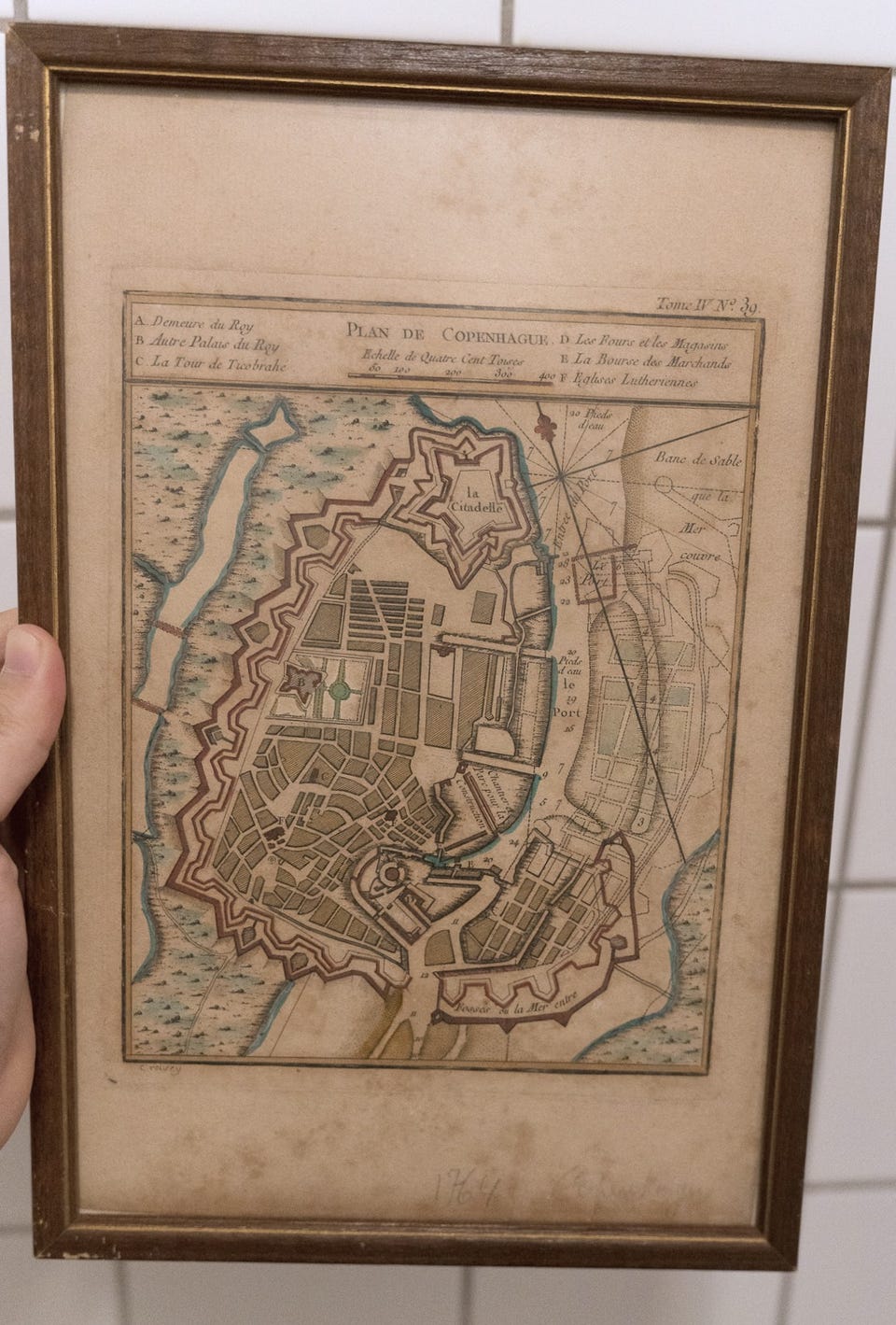
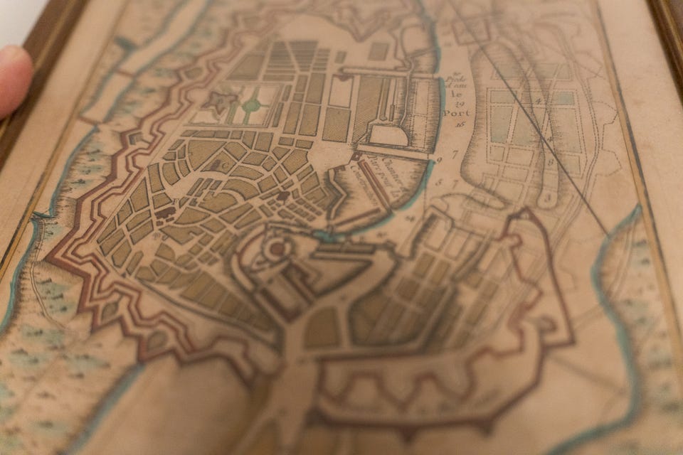
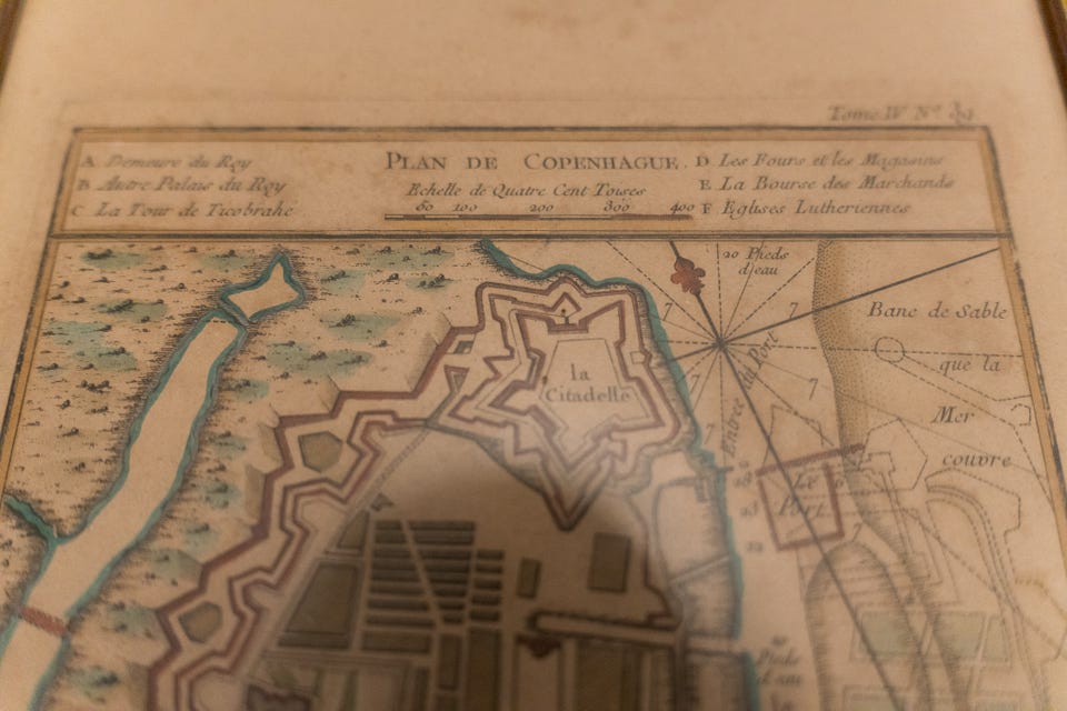
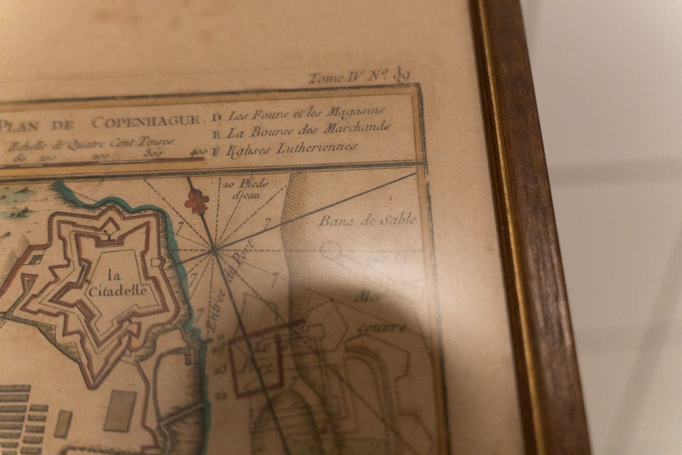
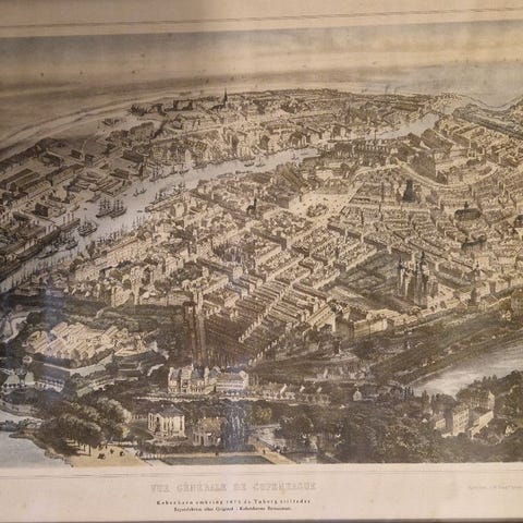
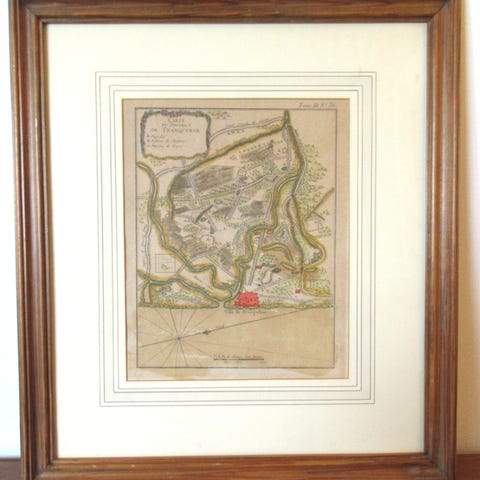
Jacques-Nicolas Bellin Plan de Copenhague (1764, Plate 39) Copperplate Engraving
Til salg
900 kr.
Varebeskrivelse
Stand: Brugt - men i god stand
A finely detailed 18th-century copperplate engraving of Copenhagen, drawn and engraved by the royal French cartographer Jacques-Nicolas Bellin. This map, titled “Plan de Copenhague”, was published as Plate No. 39 in Volume IV of Bellin’s Le Petit Atlas Maritime, issued by the Dépot des Cartes et Plans de la Marine in 1764.
This plate presents the fortified capital of Denmark in the mid-18th century, with its harbor defenses, citadel (La Citadelle), and major civic and royal landmarks marked by lettered references. The engraving includes a French-language legend indicating key structures such as the King’s Residence, Tycho Brahe’s Tower, the Merchants’ Exchange, and Lutheran churches.
This example is hand-colored, with subtle washes applied to distinguish fortifications, bodies of water, and building zones. The print is framed in a later (likely mid-20th century) wooden frame.
Condition considerations:
Moderate foxing at the bottom. Color and crispness of the etching is good/vibrant and clean.
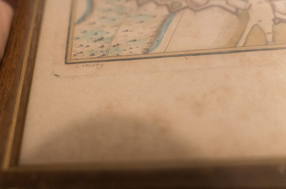
Lower Margin (handwritten annotations):
In graphite pencil:
“1764” – matching the known publication date
“Copenhague” – repeated in cursive from a previous owner
Frame: 23x34 - Glass and wood. Backing has some surface paint stains (not on the etching - but on the frame's paper backing.
You can see more information about the plate as it would have appeared in the original text:
https://www.davidrumsey.com/luna/servlet/detail/RUMSEY~8~1~233385~5509818:Carte-de-Copenhague?sort=Pub_List_No%2CSeries_No&mi=3&trs=4&qvq=q:Bellin%20Copenhague;sort:Pub_List_No%2CSeries_No;lc:RUMSEY~8~1
Brugerprofil

Du skal være logget ind for at se brugerprofiler og sende beskeder.
Log indAnnoncens metadata
Sidst redigeret: 29.4.2026 kl. 07:30 ・ Annonce-ID: 18256158